AI for Last-Meter Navigation & Maps
AI for Last-Meter Navs & Maps
DoorCity uses AI to transform building footprints into live indoor maps. Passive smartphone sensor data is processed in the background as people walk, and a second AI layer fuses it with initial maps—improving accuracy to sub-meter as more people visit. Precise AI indoor guidance. No setup. Just walk.
Vision
A community-updated AI map that makes every entrance obvious and every route effortless.
Hybrid AI + Sensor Technology
Works on any smartphone—no cameras, no calibration, no new UX. No camera. No calibration. Works on any phone.
- Robust for long walks and occlusions Robust on long walks
- Game-like community labeling with quality controls Community labels with QC
- AI models fuse sensors + crowdsourcing → sub-meter accuracy AI improves to sub-meter
- Safe—no need to look at the phone while walking Eyes-up, safe by design
Patents pending
- System Architecture for End-Point Localization.
- AI-based Assets Mapping via Background Crowdsourcing.
MVP & On-Site Demo
One workflow you can try in 10 minutes. Try the demo in ~10 min.
Three Components → One System
- AI Maps Creator — extract polygons & features. AI Maps — polygons & features.
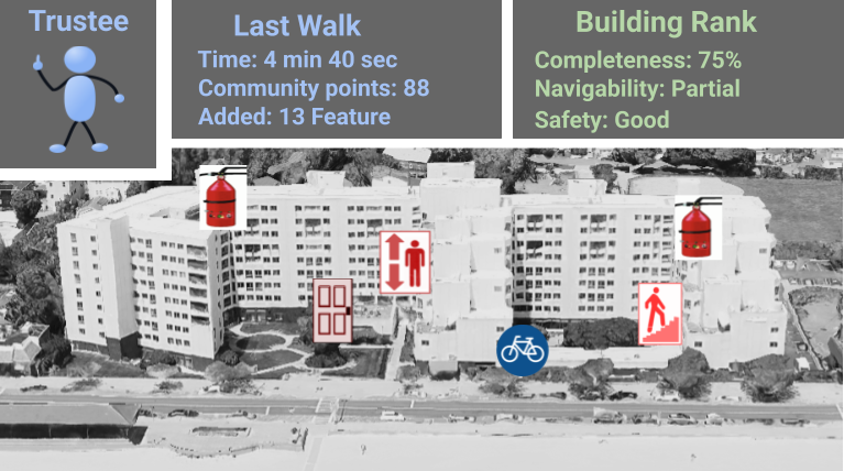
- Community Labeling App — mark entrances, doors, safety assets. Labels — entrances, doors, safety.
- Navigation App — turn-by-turn to doors & POIs. Nav — to doors & POIs.
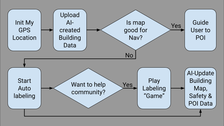
Live Demo Flow
- Pick a nearby residential or commercial building from the app.Pick a nearby building.
- Walk there with DoorCity running.Walk with DoorCity on.
- Label a few features in the building.Label a few features.
- Return and review: feature walk video & new AI map. Review overlay video & AI map.
About DoorCity
Founded by Leonid Naimark, a pioneer in sensor-based tracking (Intersense IS-1200, Dekko, Globus ExcelsiusGPS) and applied AI (DeepEye, DoorCity).
YouTube: DoorCity channel